
As I lounged in the hot tub on the deck of my cozy cabin at Red Cliffs Lodge just outside Moab, Utah, I watched the Colorado River rush by just a pebble’s toss from my feet. Then, I realized that if I could scale the sheer rust-red cliffs beyond, I’d find myself in the world-famous Arches National Park.
If I chose to visit the park, which was just a few miles away as the crow flies, I could see sandstone formations like Delicate Arch — so famous it adorns the Utah license plate. However, I was not planning to go to Arches. I prefer to savor the drama of nature away from crowds.
To enter Arches National Park, you must purchase a timed reservation months in advance, and there’s a long line of cars perpetually snaking toward the entrance. This convinced me to turn my hiking boots in other directions. After all, the forces of earth, wind, water and ice that carved and chiseled this sandstone plateau worked their magic far beyond the boundaries of the best-known parks.
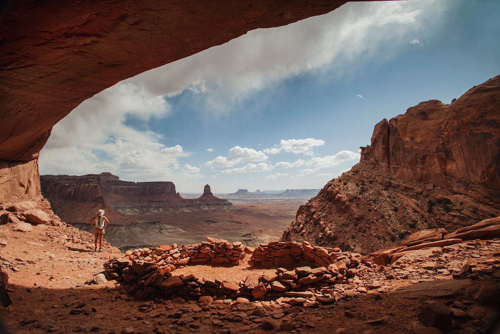
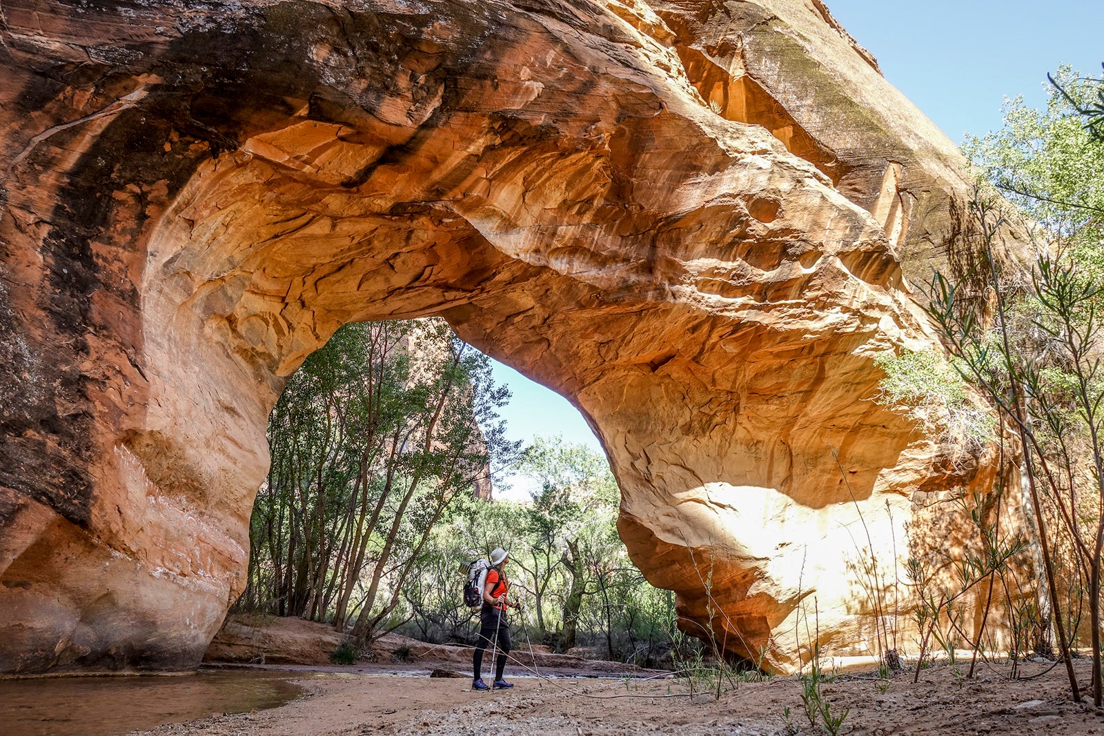
Instead of heading to Arches, I hiked to the foot of a sandstone arch just as high and delicate as its better-known neighbors. I sat under its span, framed against the deep blue sky, without another soul in sight … or in my photos.
On the way, I stopped to place my hand inside dinosaur tracks, and I admired multiple enormous panels of 2,000-year-old petroglyphs so complex that archaeologists are still struggling to decipher them. I also got to hike in solitude among dense clusters of rock spires equally as otherworldly as those that draw throngs to wildly popular Bryce Canyon a half-day’s drive away.
On our trip, we also slipped into candy-striped slot canyons, navigated the challenges of so-called slick rock on mountain bikes, swam in pools under hidden waterfalls and amassed hundreds of photos — all without spending a moment in a line with other visitors.
Utah also boasts the highest concentration of International Dark Sky Places in one state. Call up an astronomer’s map of ambient light across the continent, and you’ll see most of the state blanketed in the inky blackness that’s coveted by stargazers. To take full advantage, you’ll want to choose a hotel that’s away from the lights of town and consider the moon’s phases in your planning; your sky viewing will be far better on nights when there is little or no moonlight.
Here is a guide to seven national and state parks and government-managed lands where you’ll find echoing chasms, chiseled towers, knobby hoodoos and otherworldly landscapes. As for stargazing, four of these parks are officially designated International Dark Sky parks; those that haven’t yet won this title are still just as isolated from city lights. You can road-trip between parks and camp within them; or you can save packing and moving time by making Moab your home base since most of these parks are a daytrip distance from the city.
Dead Horse Point State Park
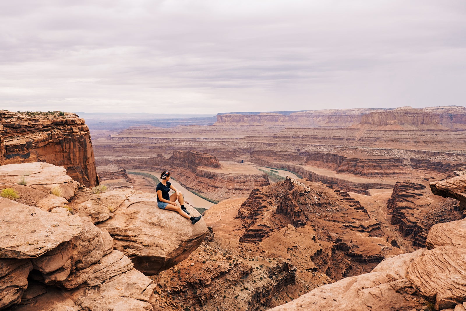
Conveniently located on a side spur off Highway 313, on the way to Canyonlands National Park’s main entrance, Dead Horse Point State Park provides some of the area’s most dramatic canyon views from a narrow peninsula overlooking a branch of the Colorado River.

Daily Newsletter
Reward your inbox with the TPG Daily newsletter
Join over 700,000 readers for breaking news, in-depth guides and exclusive deals from TPG’s experts
To gaze into its depths some 2,000 feet below, take the short, paved Dead Horse Point Trail from the visitor’s center to the overlook. You can extend this hike in either direction on the east and west loop trails, or combine them for a 4.5-mile loop with nonstop views.
A 1.5-mile spur from the west loop trail leads to Bighorn Overlook, which affords views as spectacular as those from Dead Horse Point. Plus, you’ll have them to yourself. Mountain bikers and more adventurous hikers prize the park’s Intrepid Trail System, a 16-mile network that encompasses three possible loop routes, including the popular 7.9-mile Big Chief trail.
Canyonlands National Park
One of the largest national parks in the continental U.S. at 527 square miles, Canyonlands National Park encompasses three separate sections, each accessible from a different direction.
Island in the Sky, closest to Moab, receives the majority of park visitors. They come to admire Mesa Arch and trace the canyon’s rim along the 34-mile scenic route with its string of viewpoints.
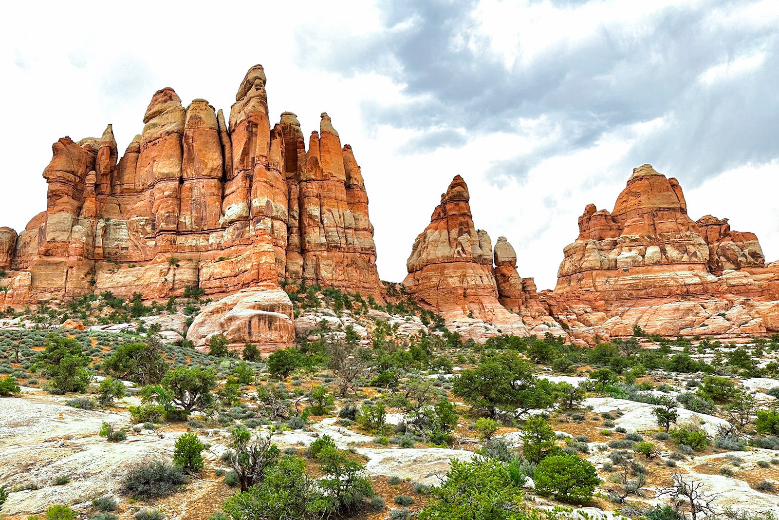
We chose to explore the canyon’s interior in the Needles District, accessed from the park’s eastern side. Hiking among rocks twisted into otherworldly shapes, we spent as much time gazing up as down. We threaded our way through a wonderland of tangerine-striped spires, whitewashed domes, shadowy clefts and mushroom-like knobs.
The visitors center in Needles District offers excellent maps, ranger talks and hiking and sightseeing advice. Follow the Needles Scenic Drive to its termination at the Big Spring Canyon Overlook for good views over the canyon; there are even better views from Pothole Point.
The Needles District’s best view requires a strenuous 10-mile trek to the Confluence Overlook, where you can see the Colorado and Green rivers meet.
From the starting point of Elephant Hill, the 5.4-mile Chesler Park trail climbs and dips and climbs again to a stunning saddle; add the side trail to eerie Druid Arch and loop back through Devil’s Kitchen for a 10.8-mile trek you won’t soon forget. Other popular sights are Wooden Shoe Arch, visible from a roadside pullout, and the 0.6-mile loop trail to Cave Spring, where remnants of historic cowboy camps have been preserved.
Bears Ears National Monument
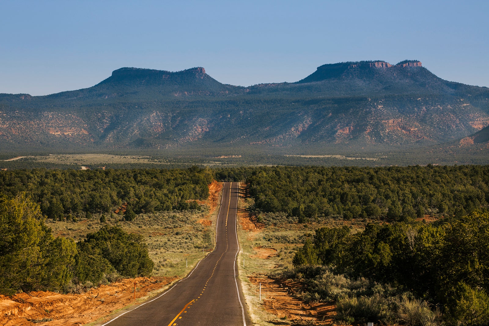
Winding its way westward toward Canyonlands’ Needles District, the Indian Creek Scenic Byway, or state Route 211, passes through a portion of Bears Ears National Monument. Here, you’ll find plenty to explore.
A relatively recent addition to the national park system, Bears Ears received monument designation in 2016. It has plenty of campgrounds for those seeking to escape it all. A must-stop is Newspaper Rock, an aptly named expanse of rock covered with centuries’ worth of petroglyphs and pictographs on one side; there are mysterious messages spanning 1,500 years ago to the mid-20th century.
The southern part of the monument, accessed from the Trail of the Ancients Scenic Byway, protects ancient Ancestral Puebloan cliff dwellings. Among the monument’s favored hiking trails are those leading into Butler Wash, Arch Canyon and Mule Canyon.
Goblin Valley State Park
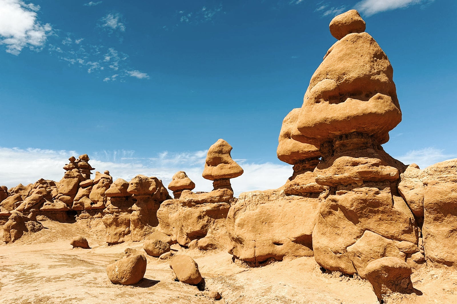
Probably the most accurately named of all the Utah parks, Goblin Valley State Park resembles a giant fantasyland of petrified mud. Formations shaped like gnomes, trolls, animals and, indeed, goblins crowd a bowl-shaped valley. Visitors can clamber, hide and peek out as if in an enormous playground.
Seemingly in tribute to the childlike appeal of the landscape, the three areas that comprise Valley of the Goblins offer free hiking. This means there are no marked trails, and the entire area is open to explore.
Beyond the cliffs that form the far wall of the Valley of Goblins, on the park’s eastern boundary, a marked trail leads to The Goblin’s Lair — a slot canyon sealed off by a rockfall to form a cavernous grotto.
Capitol Reef National Park
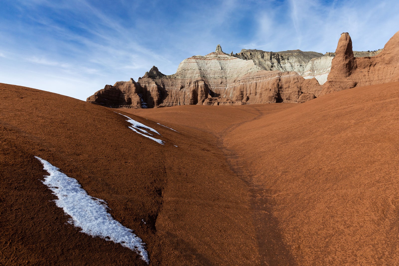
Ask red-rock canyon aficionados to name their favorite park, and it may surprise you how many answer Capitol Reef National Park. But a visit to this 100-mile-long slice of canyon country known as the Waterpocket Fold quickly reveals the reasons.
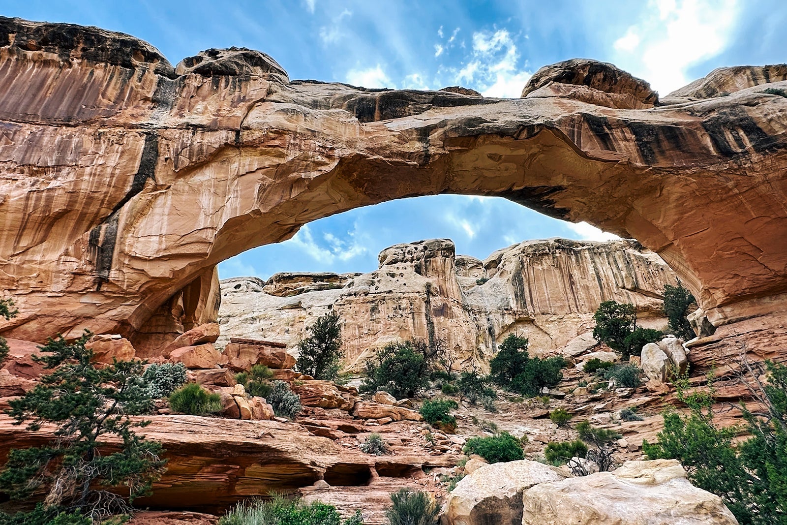
The area’s quilt-patterned topography provides something of a sampler plate of all the other parks. You’ll find sky-scraping ocher cliffs sliced by a tumbling river, water-sheered chasms, towering rock chimneys and spires. There’s even an arch, known as Hickman Bridge, that provides a particularly breathtaking picture as it spans a deep wash.
Another aspect of Capitol Reef’s appeal is the ease of access; many of the park’s biggest attractions, including the vertigo-inducing viewpoints Sunset Point and Goosenecks Overlook, cluster fairly close together along Highway 24 (which runs east-west through the northern end of the park).
A few more highlights stud the park’s scenic drive, which turns south from the visitors center, but it is closed until October 2024 for repairs. Those determined to see the most popular of these sites, Cassidy Arch, can still reach it via an ambitious 8.5-mile hike.
Unlike other red rock parks, Capitol Reef also showcases the region’s pioneer history, preserving a historic ranch and schoolhouse in the Fruita Historic District. The orchards planted by the first Mormon settlers continue to bear fruit, which is harvested and turned into flaky pastries sold in the district’s still-working bakery.
Grand Staircase-Escalante National Monument
An hour southwest of Capitol Reef on one of the prettiest stretches of a trip full of stunning drives, you’ll reach the northern portion of Grand Staircase-Escalante National Monument, a 1.87-million-acre expanse of high desert mesa. It’s deeply etched by canyons that conceal a wealth of towering waterfalls, verdant valley oases and hidden caves and slot canyons.
Getting there is half the fun as you head south on Utah Scenic Byway 12 — a stretch of road so spectacular it’s also designated an All-American Road by the Federal Highway Administration. It was named “A Journey Through Time Scenic Byway” for the many historic sites that dot the route.
The trailheads for two of the park’s best hikes are right on this road: those to Upper (2.6 miles round-trip) and Lower Calf Creek Falls (6.7 miles round-trip). Both end in splashing cascades and swimmable pools. A little more than eight miles farther along the unpaved Hole in the Wall Road, the 5.2-mile hike to colorfully striped Zebra Canyon is a favorite for photo ops. However, getting to the narrower part of the canyon sometimes requires wading in thigh-deep water.
Kodachrome Basin State Park
Easily overlooked by those intent on visiting Bryce Canyon National Park, Kodachrome Basin State Park offers its own version of rock spires — 67 of them, in fact. They are about 180 million years old and known as sand or sedimentary pipes for their spindle-like thinness.
Surrounded by Grand Staircase-Escalante National Monument on three sides, the 2,241-acre state park could just as easily be named Candyland for its pink-and-white-striped bluffs, Creamsicle chimneys and caramel-colored slickrock. The 5.6-mile Panoramic Trail Long Loop earns its name thanks to its famous vistas and takes you through a cave for extra fun.
You’ll also have camera-pleasing views from the 1.7-mile Shakespeare Arch trail, but note that the arch itself collapsed a few years ago.
Where to stay
Like a summer camp without the dinner bell and prying counselors, Red Cliffs Lodge operates a full-service hideaway on the banks of the Colorado River. It features a string of wood-paneled cabins oriented to face the rushing current and towering cliffs.
Tucked into a private valley, the expansive property shelters a wealth of wildlife. Great blue herons fish for breakfast, geese teach their goslings how to swim, and falcons and hawks soar from the clifftops.
The resort’s on-site restaurant, the Cowboy Grill, draws diners from Moab as well as guests with its signature rib-eye steaks and its glass-walled dining room and deck. In addition to stargazing, the resort offers an extensive menu of activities, from yoga and sound healing to river rafting and Jeep tours.
The lodge’s history as a working ranch is still evident in the tavern’s western vibes and an evocative history museum, the Moab Museum of Film and Western Heritage; it documents the area’s long tenure as a filming location for westerns and other movies. From John Wayne, Rock Hudson and Henry Fonda thundering out of the cliffs on horseback to Thelma and Louise’s plunging convertible ride, a host of famous scenes were shot here, and it’s fun to make the connections. Nightly rates at Red Cliffs Lodge start at $359.
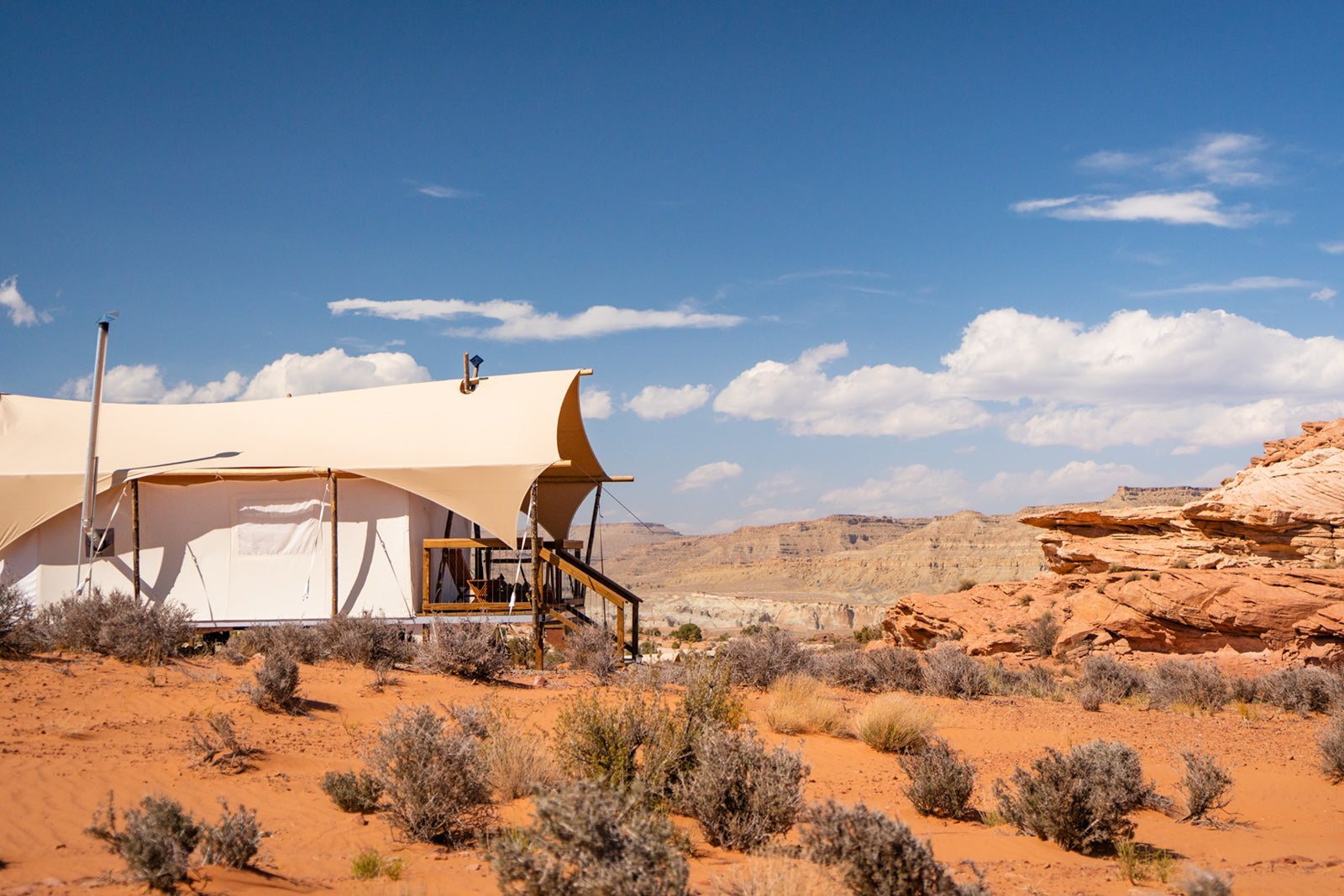
Singularly convenient to Canyonlands National Park’s Needles District from its location southwest of Moab, Ulum Moab is the newest offering from popular glamping brand Under Canvas. The company operates resorts adjacent to numerous national parks, including Yellowstone, Yosemite and the Grand Canyon.
Golf carts whisk guests across the car-free property to 360-square-foot canvas tent cabins equipped with full bathrooms, wood-burning stoves, air coolers and coffee and tea systems. A restaurant, pool and three hot tubs in graduating temperatures top a rise facing Looking Glass Rock; its round window frames the sunset for an extraordinary experience. Outdoor fire pits with complimentary s’mores ingredients provide an idyllic backdrop to end the evening. Rates at Ulum Moab start at $624 per night.
Lodging choices abound in the lively town of Moab alongside the plethora of adventure outfitters, bike shops and restaurants that range from gourmet to food trucks. Marriott Bonvoy members will especially appreciate the variety of choices. Book Element Moab starting at 50,000 points or $175 per night; Fairfield Inn & Suites starting from 56,000 points or $303 per night; or SpringHill Suites starting at 63,000 points or $244 per night.
Hilton Honors members can choose from Homewood Suites, with rooms from 64,000 points or $227 per night, or Hoodoo Moab from the Curio Collection, with rooms from 61,000 points or $249 per night. The Hampton Inn Moab offers rooms from 59,000 points or $217 per night.